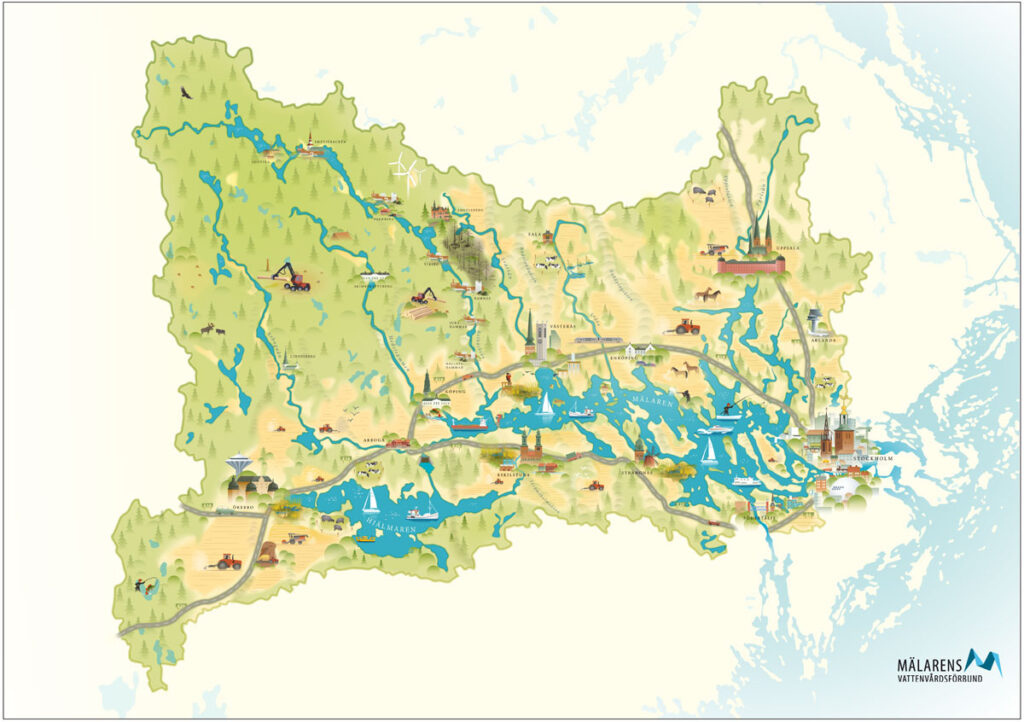
The area from where water accumulates in Lake Mälaren is 22 650 square kilometers, which corresponds to about 5 % of the area of Sweden, and surrounds the lake like a rectangle. The area extends mainly westward in relation to the lake.

The area also includes Hjälmaren, which is Sweden’s fourth largest lake, and a number of smaller lakes. The area extends over Stockholm County and parts of Uppland, Västmanland, Närke, Dalarna and Södermanland counties.
Everything that happens in the area, like emissions, determines the conditions in the water environment in Mälaren. Therefore, the entire area needs to be the basis for decisions about what to do to address water problems in the lake.
Facts
Mälaren is Sweden’s third largest lake and has an average depth of 12.8 meters and a maximum depth of 66 meters. Its outlet goes via Slussen in Stockholm to Norrström, which has an average water flow of just over 160 cubic meters per second.
Mälaren is a typical lowland lake with over 8 000 islands, islets and skerries. Six counties and around 40 municipalities are located within the area from were water flows to Mälaren, which has a population of almost one million people. Several rivers flow into Mälaren, including the Arbogaån, Kolbäcksån, Eskilstunaån, Svartån, Sagån, Råcksta å and Fyrisån.
- Lake area: 1 122 square kilometers
- Volume: 12.4 cubic kilometers
- Length: 72 kilometers
- Average depth: 12.8 meters
- Greatest depth: 66 meters
